Molly Barr Road runs from Jackson Avenue north to North Lamar, past the police station and Stone Park. It is in ZIP 38655 and the Oxford School District.
Last checked Oct. 16, 2026. Sources: the City of Oxford’s Vision 2037 Comprehensive Plan (PDF) and city limits map layer, the Census Bureau’s school district boundaries, the Mississippi Department of Education’s report card, Zillow Research, Oxford-University Transit, the Oxford Park Commission and OpenStreetMap.
Molly Barr Road links Jackson Avenue, west of the Square, with North Lamar Boulevard on the north side of town. The city’s Vision 2037 plan names it, with College Hill Road, Old Taylor Road and Sisk Avenue, as one of the roads that reach Oxford’s residential neighborhoods. City buildings, Stone Park and the city pool are near its south end.
What this means for you
- Schools: the Oxford School District, which assigns by grade: every student goes to Oxford High for grades 9 to 12. The district rated A for 2024-25.
- Home value: $417,122 in ZIP code 38655 in August 2026, according to the Zillow Home Value Index.
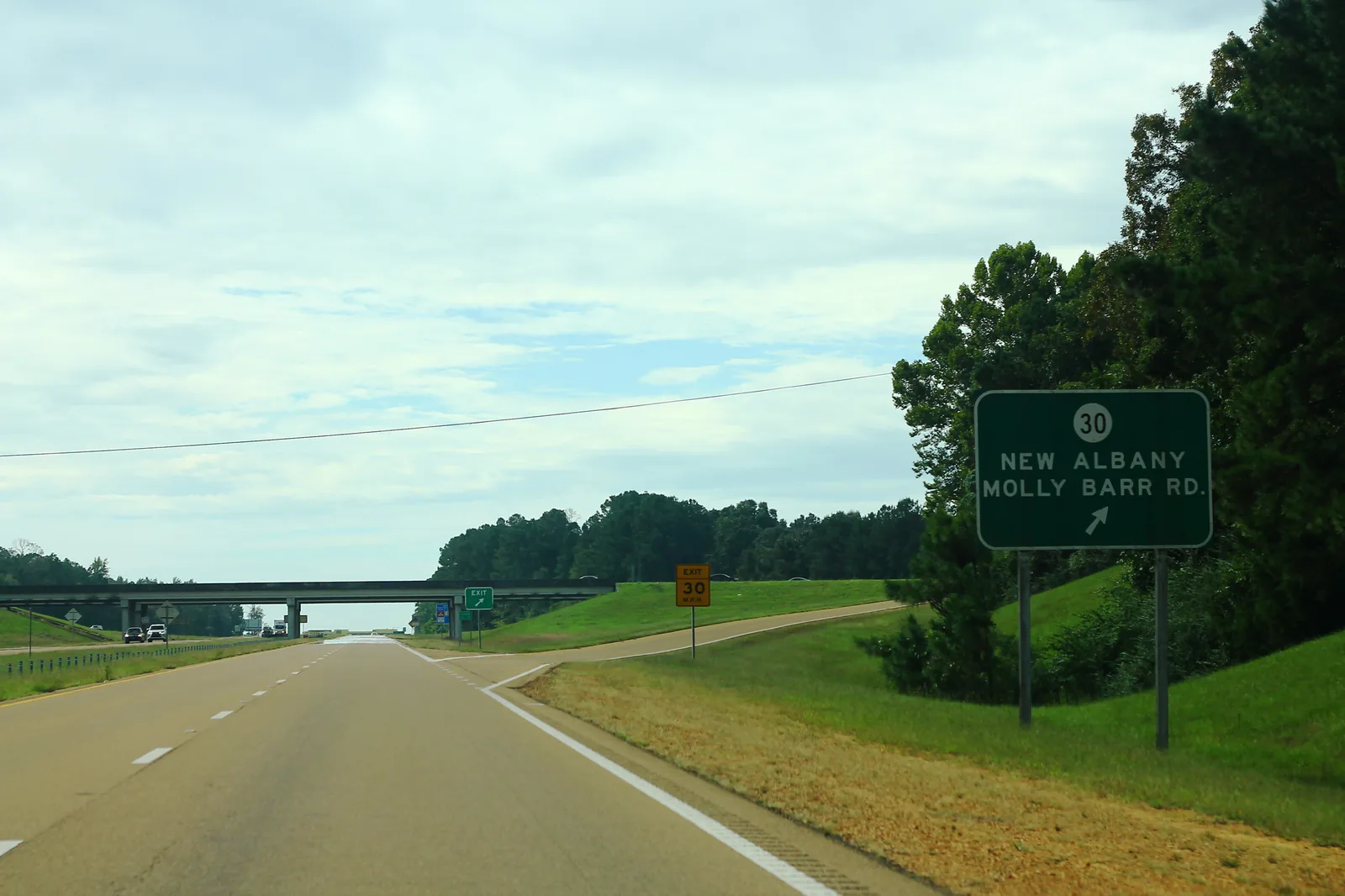
- Nearest highway interchange: Highway 7 at Highway 30, signed for Molly Barr Road, about half a mile east of the road’s north end.
Part of our Oxford neighborhoods guide.
Where it is
On OpenStreetMap, Molly Barr Road leaves Jackson Avenue near the Oxford Depot Trail, runs north past Washington Avenue and McElroy Drive, then bends east to meet North Lamar Boulevard. The whole road is inside the city limits and in ZIP code 38655. On the city’s current ward map it crosses Wards 4 and 1. OpenStreetMap names Molly Barr Cove as a place off the road.
Public buildings on or near it include:
- Oxford Police Department headquarters, 715 Molly Barr Road, listed in the Vision 2037 plan
- City Shop (Municipal Center), beside the police station, one of the city’s recycling drop-off points; see our trash and recycling guide
- Oxford-University Transit, 409 McElroy Drive, the bus system’s base
The city’s interactive zoning map shows the zone for a single lot.
Schools
The Census Bureau’s school district map puts all of Molly Barr Road inside the Oxford School District. The district groups schools by grade, so every student attends the same building for a given grade. Central Elementary and Oxford Intermediate are both a short distance from the road’s south end. Grades are from the state’s 2024-25 report card:
| School | Grades | State grade, 2024-25 |
|---|---|---|
| Oxford Early Childhood Center, 1637 Highway 30 East | Pre-K | A |
| Bramlett Elementary, 225 Bramlett Blvd. | K-1 | A |
| Della Davidson Elementary, 209 Commonwealth Blvd. | 2-3 | A |
| Central Elementary, 409 Washington Ave. | 4-5 | A |
| Oxford Intermediate, 501 Martin Luther King Jr. Drive | 6 | B |
| Oxford Middle, 224 Bramlett Blvd. | 7-8 | A |
| Oxford High, 101 Charger Loop | 9-12 | A |
The same Census map shows that parts of the city’s northwest side are in the Lafayette County School District. Confirm a specific property with the Lafayette County Tax Assessor, 662-234-5562, as the Oxford district asks. More in our schools guide.
Home values
Zillow does not publish a figure for Molly Barr Road. Its index for ZIP code 38655 was $417,122 in August 2026, up 3.3% from $403,970 in August 2025, according to the Zillow Home Value Index. The city’s figure was $416,262. The index is a modeled typical value for homes in the middle of the market, not a sale price. See our home prices guide.
Parks and trails
From the Oxford Park Commission and OpenStreetMap:
- Stone Park, 432 Washington Ave., under a tenth of a mile from the road: playground, pavilion, batting cage and two basketball courts
- Oxford City Pool, Washington Avenue across from Stone Park, open in season
- Oxford Depot Trail, the paved path, which passes within about a tenth of a mile of the road’s south end
More in parks and trails and summer camps and pools.
Getting around
- Highway 7: the Highway 30 interchange, signed for New Albany and Molly Barr Road, is about half a mile east of the road’s north end, per OpenStreetMap.
- The Square: about 1.2 miles by road from the middle of the road, measured on the OpenStreetMap road network.
- Memphis International Airport: about 68 miles by road on the same network. Both are distances, not drive times.
- Buses: three OUT routes touch the road, according to OUT’s route page: Red North stops at Molly Barr and Washington Avenue, Yellow at Molly Barr and McElroy Drive, and Blue West at Jackson Avenue and Molly Barr. All run weekdays every 30 minutes; Yellow has limited Saturday service. Rides are free.
Groceries and everyday stores
OpenStreetMap shows no supermarket on Molly Barr Road. The closest store it maps is Myers Apothecary, 653 Concordia Ave., under a fifth of a mile from the road’s north end. Our getting around guide covers the bus routes to the University Avenue and Jackson Avenue West stores.
Trash pickup
The city collects garbage twice a week. Look up an address on the city’s garbage route map; holiday changes are in our trash and recycling guide.
Frequently asked questions
Where is Molly Barr Road in Oxford, Mississippi?
It runs from Jackson Avenue, west of the Square, north and then east to North Lamar Boulevard. The whole road is inside the city limits, and the police station and City Shop are on it.
What schools serve Molly Barr Road in Oxford?
It is in the Oxford School District, which assigns schools by grade, not by neighborhood. Central Elementary, 409 Washington Ave., and Oxford Intermediate are each about a quarter to a third of a mile from the road’s south end.
Is there a bus on Molly Barr Road?
Yes. OUT’s Red North route stops at Molly Barr and Washington Avenue, the Yellow route at Molly Barr and McElroy Drive, and Blue West at Jackson Avenue and Molly Barr. Rides are free.
What is the typical home value near Molly Barr Road?
Zillow does not split Oxford by neighborhood. Its index for ZIP code 38655 was $417,122 in August 2026, up 3.3% in a year. It is a modeled typical value, not a sale price.
Have your say